Analyze complex geographical data, process and modify map images, edit rasters, vectors and databases, with this complex GIS application. #GIS Software #Edit Geodata #Surface Modeling #GIS #Vector #Raster
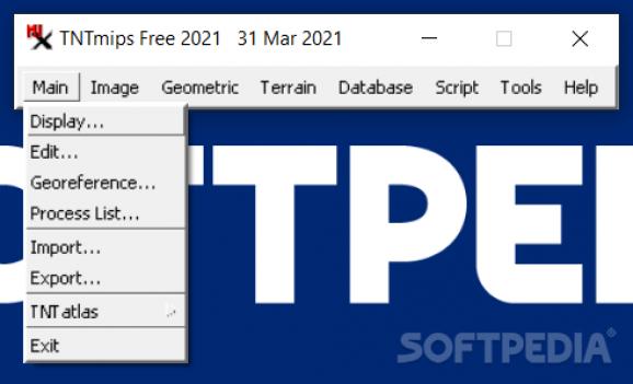
TNTmips is a comprehensive Geographic Information System (GIS) designed to help you work with various types of geospatial data, create maps, analyze geographical information and create three-dimensional models from inserted data.
When creating a raster image of a map, it is important for it to be associated with actual spatial locations. This allows it to be used for various purposes and in conjunction with other projects, as various data sets can be overlaid.
TNTmips supports a wide array of coordinate reference systems and allows you to define your own. You can also import or edit georeference information that is already included in your project, should it need to be corrected.
Using the application's display function, you can explore and visualize geospatial data in multiple ways. You can load multiple data layers and overlay them, to view various types of information at the same time.
TNTmips enables you to create complex maps, using various types of objects for visual reference. You can process data that is already in digital form, as well as import scanned physical maps and create rasters and geometric objects.
Once you have loaded a raster image of a physical map, you can trace contour lines to create vectors that offer digital representations of elevation data, watersheds, terrain types and many others. Then, you can label the created contour lines and assign values to each of them.
TNTmips offers a surface modeling feature that allows you to create 3D representations of natural terrains and mathematical surfaces using provided information.
You can perform surface fitting, contouring, triangulation and profiling operations to produce Digital Elevation Model rasters (DEMs), triangulated irregular networks (TINs) and contour lines.
Overall, TNTmips is a complex piece of software, aimed at users who need to view, edit and interpret various types of geospatial data. It is packed with functions, but features a rather outdated interface, which some users may find difficult to operate.
Download Hubs
TNTmips is part of these download collections: GIS Tools
TNTmips 2022 Build 20221207
add to watchlist add to download basket send us an update REPORT- PRICE: Free
- runs on:
-
Windows 11
Windows 10 32/64 bit
Windows 8 32/64 bit
Windows 7 32/64 bit
Windows Vista 32/64 bit
Windows XP 32/64 bit - file size:
- 115 MB
- filename:
- TNT_2022_App_Win32_20221207.exe
- main category:
- Maps / GPS
- developer:
- visit homepage
calibre
Zoom Client
Microsoft Teams
7-Zip
IrfanView
Bitdefender Antivirus Free
Windows Sandbox Launcher
ShareX
4k Video Downloader
paint.net
- ShareX
- 4k Video Downloader
- paint.net
- calibre
- Zoom Client
- Microsoft Teams
- 7-Zip
- IrfanView
- Bitdefender Antivirus Free
- Windows Sandbox Launcher
