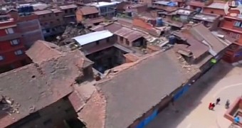
The earthquake that devastated Nepal and left thousands of people dead this weekend shifted the earth beneath Kathmandu by up to several meters south.
The massive 7.8-magnitude quake on Saturday was the Himalayan nation’s deadliest disaster in more than 80 years, killing over 4,300 people and causing massive destruction throughout the capital and beyond.
A full assessment of the aftermath is not yet complete, and as Prime Minister Sushil Koirala said, the death toll could rise up to as much as 10,000 over the upcoming weeks.
But amidst the chaos and confusion following the cataclysmic event, some individuals wanted to document the aftermath of this major catastrophe for posterity.
A 1.42-minute drone aerial footage posted by The Guardian briefly shows the massive scale of destruction caused by the earthquake just a few days ago. The images are extremely graphic and telling, showing piles of collapsed buildings left in ruin, hordes of people roaming the streets, and the camps where refugees have taken up residence.
Another video posted on YouTube shows the extent of the inflicted damage on one of the UNESCO World Heritage sites in Swoyamhu, which is believed to have been established more than 2,500 years ago, thus being of great historical importance.

 14 DAY TRIAL //