14 DAY TRIAL //
 Reading a map is an essential skill for many walks of life, especially geographers and the military, but there are plenty of other sorts of maps that can be made, from simple schematics to elaborate illustrations of a campus.
There is one problem that all of them have though, if you can call it that: they need to be read. As in, you need to look at them in order to make heads or Tails of it.
This means that if you're blind or otherwise visually impaired to the degree where you can't make anything out properly, you're in for a tough time.
The solidarity of man might enable you to find someone to explain your location to you, but giving or receiving directions will get awkward fast.
People with visual impediments have to travel with someone who doesn't have that problem, in order to get around.
Tactile-graphics company Touch Graphics and University of Buffalo's IDeA Center wanted to provide those people with another option though.
A touch-capable 3D map
Touch Graphics and the University of Buffalo's Center for Inclusive Design and Environmental Access (what we previously dubbed the IDeA Center) have created a new interface technology, of a sort.
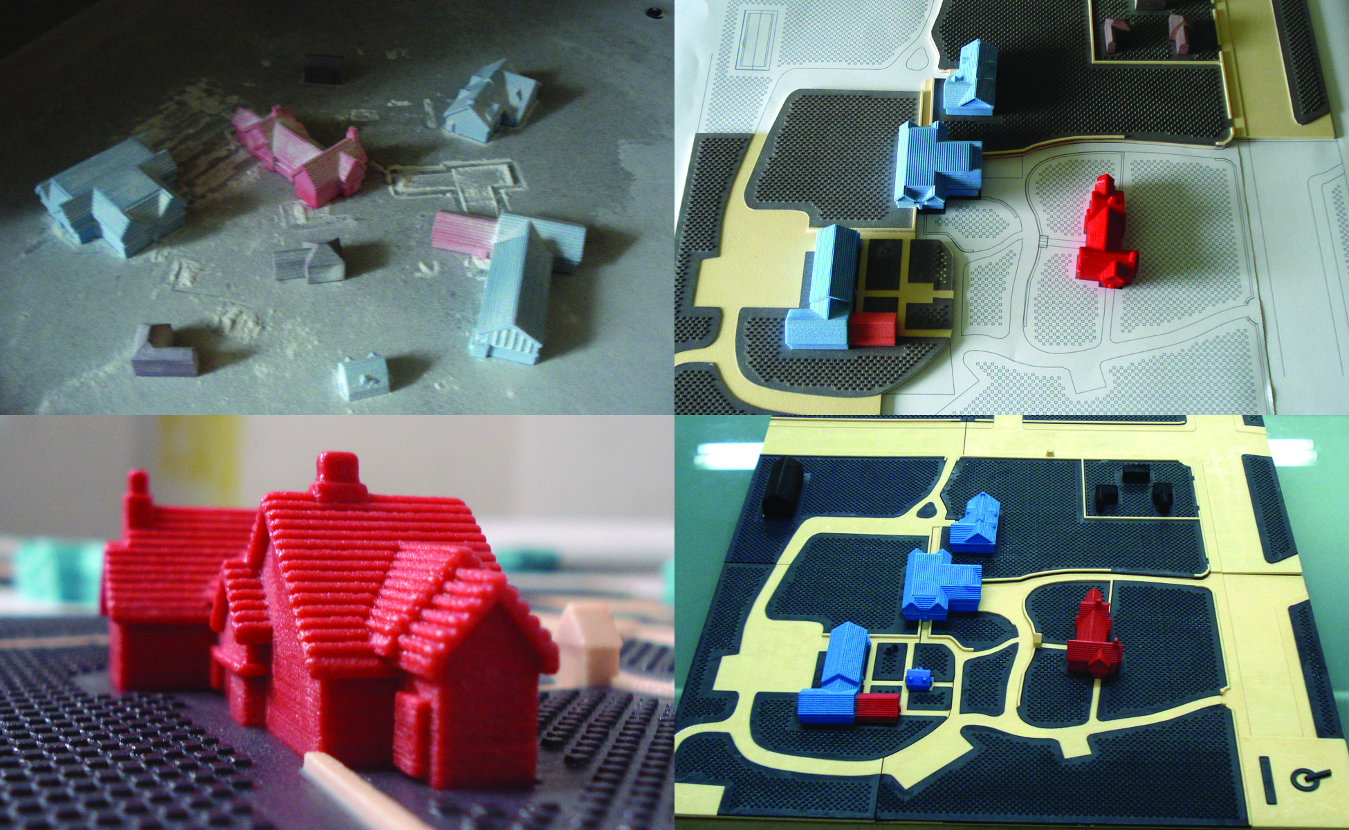
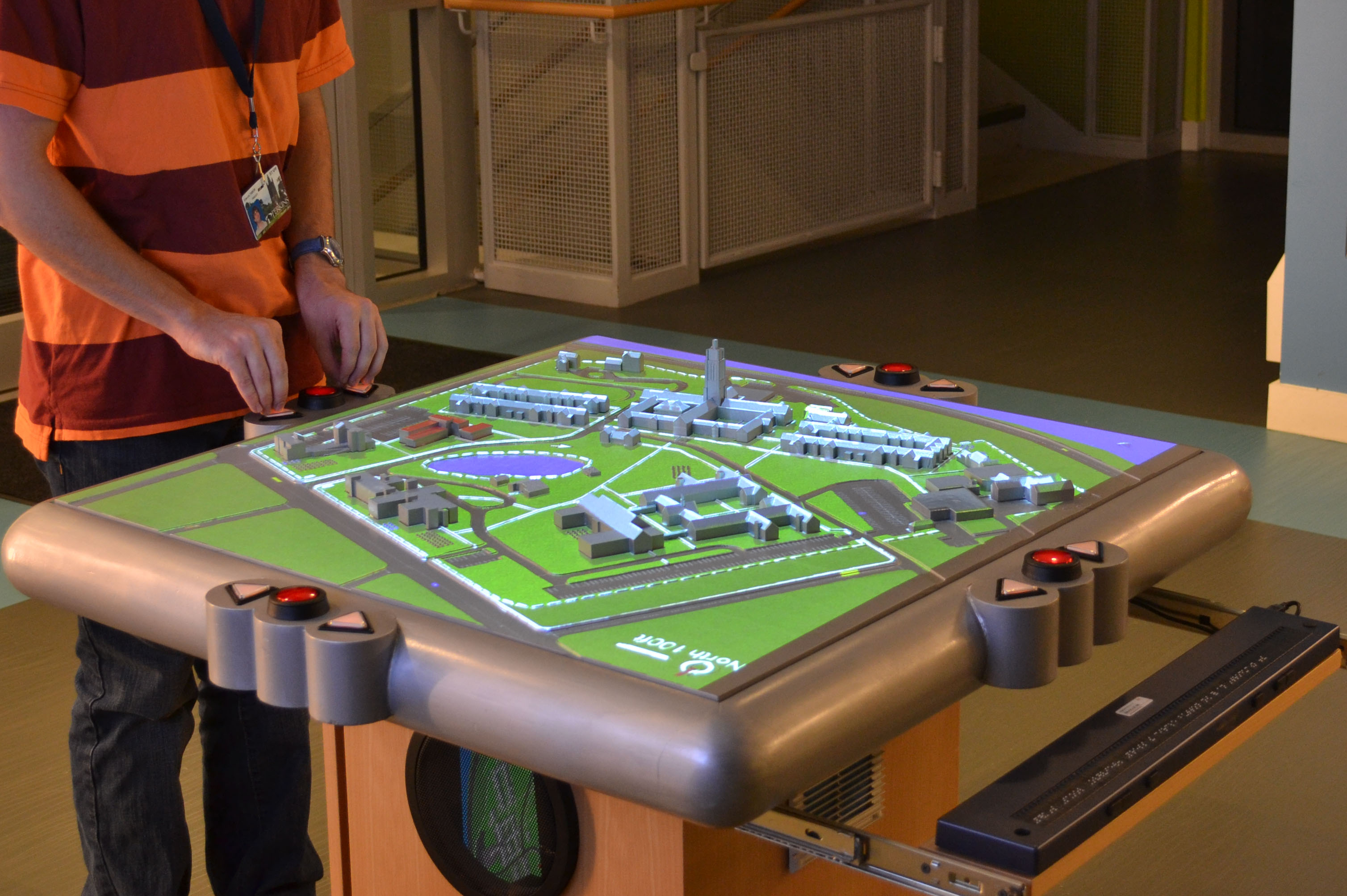
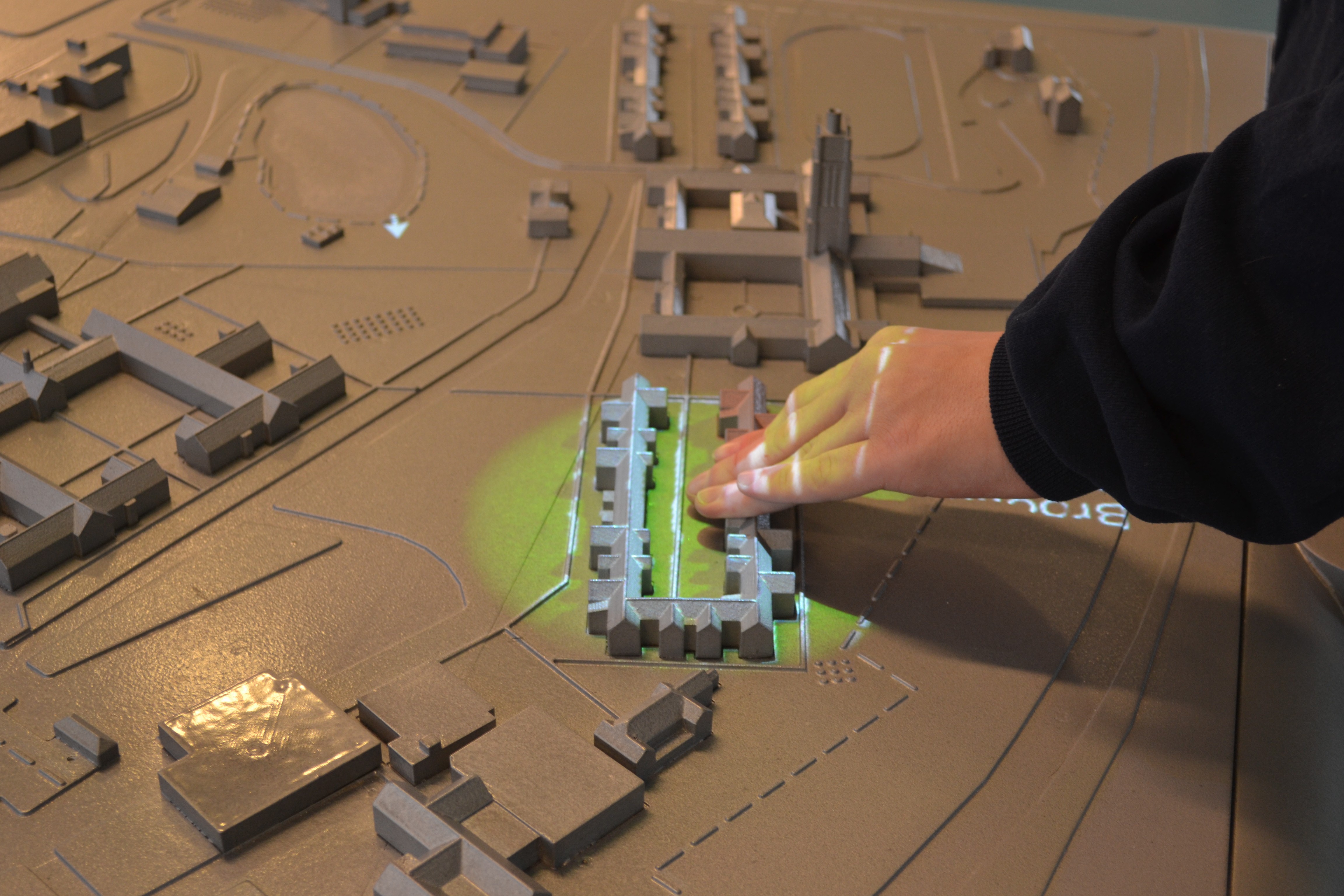
It is a multi-sensory, three-dimensional model of the location you're in. A 3D map in other words, which allows people to reach out and touch it, thus providing what's needed for them to visualize their surroundings.
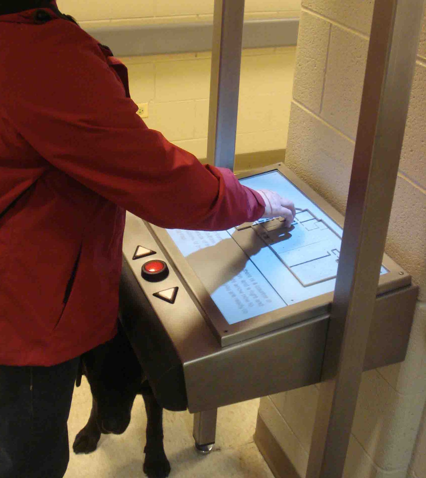
Made from miniature buildings, the map will sense pressure from fingers and send signals to sensors housed in the pedestal. At that point, a computer announces building names and offers directions throughout your interaction with the map.
Holding the fingers in place will provide more information. Moreover, an overhead video projector uses a spotlight to illuminate the place you're touching, which can be good for nearsighted people.
It won't help the fully blind all that much, but their condition isn't something that can be alleviated through other means either. Until someone created a technological replacement for eyes or at least retinas, they will have to make do with canes and guide dogs, as well as friends and family.
Practical applications of the maps
The 3D guidance system for people with visual impairments has been deployed to three installations so far, like the Perkins School for the Blind in Massachusetts. The Overbrook School for the Blind in Philadelphia will get one next, as well as a video screen that will illuminate the mini buildings from below.